
360-Straßenansicht-Bilder
Professional 360° street-level imagery have become an essential tool for daily operations in municipalities and cities. With FieldROAD™, you gain access to a powerful, cloud-based 360 street view solution delivering ultra-high-resolution, geographically accurate insights captured along roads and rails.
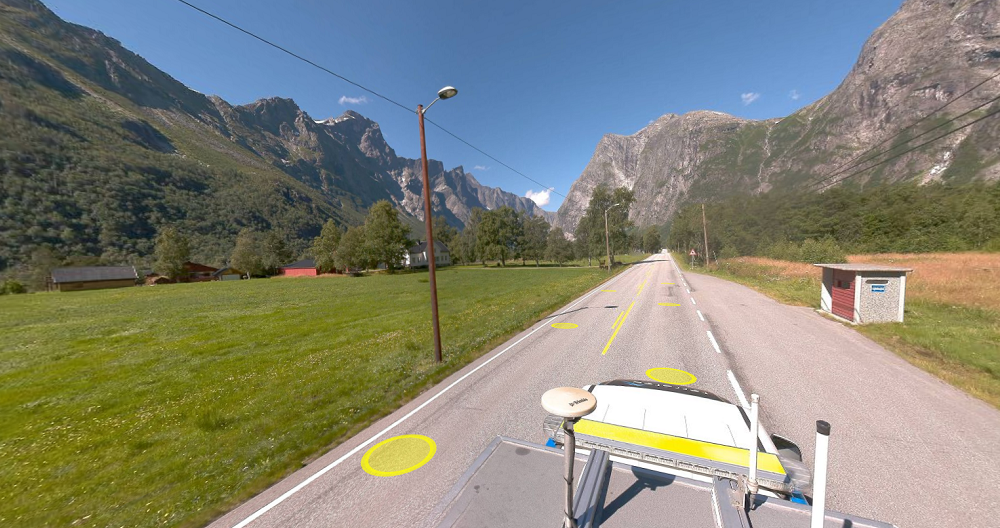
High-resolution, geospatially accurate street-level imagery for professional users.
FieldROAD™ is our premium 360° street view imagery product, designed for municipalities, infrastructure owners, and organizations that need reliable data for planning, documentation, and asset management.
FieldROAD™ delivers systematically collected street-level imagery with precise geographic positioning. The product is available through Mapspace, our cloud-based web portal where customers can access, analyze, and integrate their data — without any installation or local storage requirements.
The service provides:
- 360° panoramic street images
- HD image resolution
- Highly accurate image positioning (PPP/IMU/DMI)
- Measurement capabilities based on a laser-scanned surface model
Using advanced navigation systems, imagery is systematically captured to ensure consistent coverage and precise georeferencing. You always know where and when each image was taken.
![]()
Advanced measurements of street environments
The solution allows you to perform accurate measurements directly in the street images. Measurements are based on a surface model generated from laser scanning conducted simultaneously with image capture.
This allows you to:
- Measure distances and heights directly on screen
- Register objects in the street environment
- Collect infrastructure data efficiently
- Perform digital street inventory
All objects visible in the imagery can be recorded directly within the interface, making our solution a powerful tool for street-level data collection.
AI-Based Traffic Sign Recognition
We also offer AI-powered recognition and registration of traffic signs using FieldROAD™ imagery. This enables automated detection and documentation, saving time and increasing accuracy in road asset management workflows.
Seamless GIS Integration in Mapspace
To maximize value, FieldROAD™ can be integrated with your own geographic datasets inside Mapspace. By combining your GIS data with up-to-date 360° imagery, you gain a comprehensive operational overview that supports:
- Infrastructure planning
- Maintenance management
- Asset documentation
- Public space administration
Contact us if you have any questions or if you would like a demonstration of the solution.


Kontakt aufnehmen


Mobile Kartierung & Geophysik
Mit Laserscannern, die auf einem Auto montiert sind, können wir Millionen von Punkten pro Sekunde erfassen. Diese sehr detaillierte Punktwolke wird für die Erstellung von 3D-Vektormodellen verwendet und ist die Grundlage für die Erstellung eines TIN-Modells für fortgeschrittene Anwendungen. Gleichzeitig mit dem Scannen können auch Bilder und Videos aufgenommen werden. Bei den Bildern handelt es sich um 360-Grad-Straßenansichten, die in einem separaten Web-Viewer, Mapspace, aufgerufen und verwendet werden können. Wir können auch Informationen über den Straßenzustand sammeln und mit Hilfe von Bodenradar Versorgungsleitungen, Grundwasser und Gestein kartieren. Informieren Sie sich über unsere anderen mobilen Kartierungs- und Geophysikdienste.


