
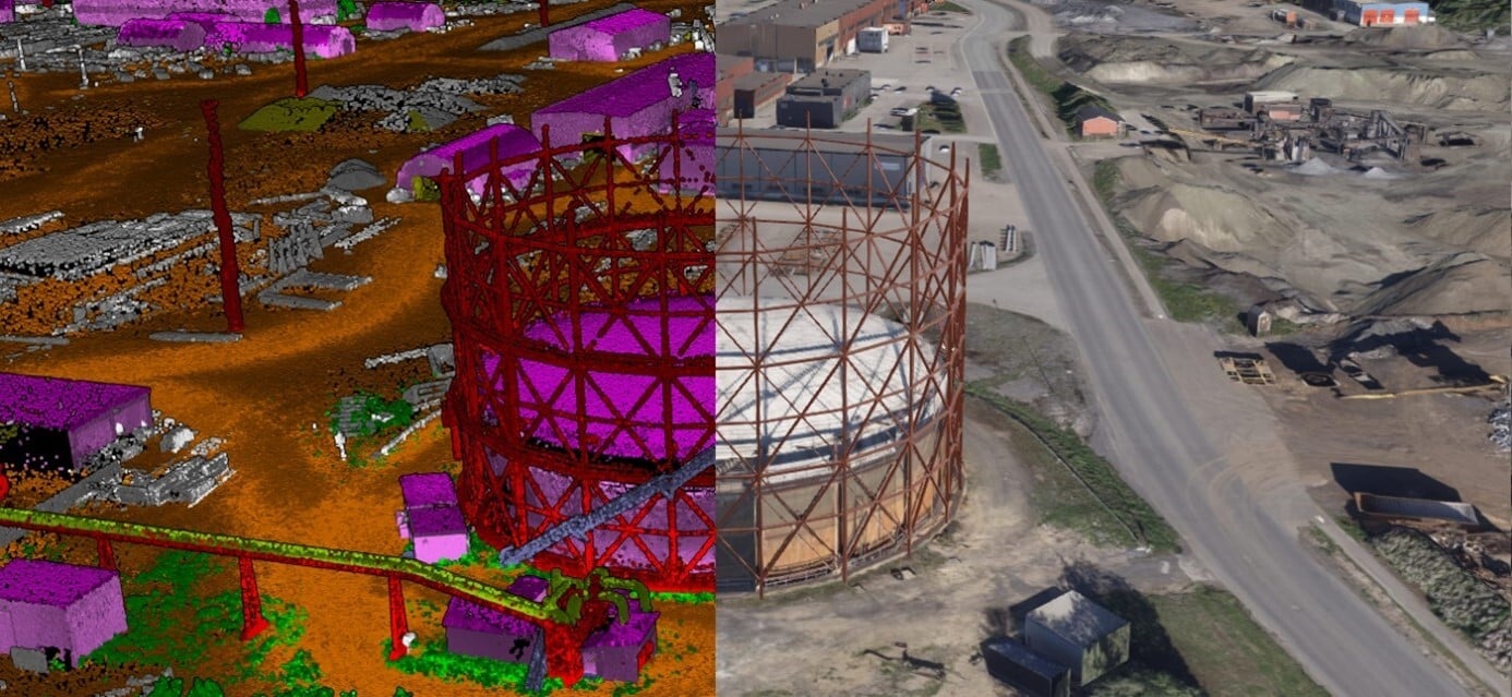
Digitale Zwillinge und 3D-Modelle
Field ist in der Lage, eine umfassende digitale Zwillingslösung zu entwickeln und zu liefern, bei der eine Reihe von hochmodernen Sensoren zum Einsatz kommen, darunter unbemannte Drohnen mit Laser- und Bilderfassung, Lidar- und Bildsensoren aus der Luft, mobile Kartierungssensoren, 360-Grad-Straßenansichten, terrestrisches Laserscanning und Laserscanning in Innenräumen.
Kontakt aufnehmen


Kartierung & Modellierung
Field bietet eine breite Palette von Geodaten- und Kartierungsdiensten an, z. B. Stadt- und Korridorkartierung, fernerkundungsbasierte Waldinventur und standortbezogene Dienste. Wir leben in einer digitalen Welt, in der digitale Modelle von physischen Objekten zum Standard gehören. Planung, Bau und Wartung erfolgen in 3D, was Kosten spart und die Effizienz erhöht. Wir verfügen über umfangreiche Erfahrung in der Verarbeitung von Geodaten zu 3D-Modellen von Städten, Infrastruktur, Gebäuden, Gelände und Meeresboden. Weitere Field Mapping & Modelling Dienstleistungen finden Sie unten.


