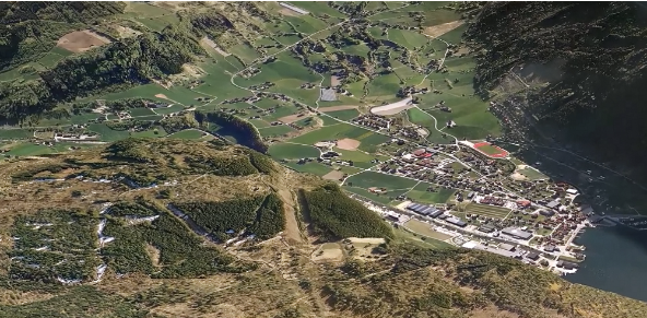
Dienstleistungen
Laser scanning with LiDAR technology have gradually become standard methods for digitizing terrain in 3D. Field has been a pioneer in the Nordic countries, first implementing airborne and later vehicle-mounted laser scanning (Mobile Mapping). In recent years, we have expanded our flight operations across Europe and beyond. We carry out airborne mapping projects for both private and public sector clients, providing valuable insights into the development of terrains, seas, natural landscapes, and urban areas.

LiDAR technology captures the world in 3D, turning landscapes, cities, and forests into highly detailed digital maps. With this technology, we can see terrain, vegetation, and infrastructure like never before, providing actionable insights for smarter planning, design, and decision-making.
LiDAR (Light Detection and Ranging) uses laser pulses to measure distances with extraordinary precision. These pulses are emitted from airborne or ground-based sensors and reflected back from the surfaces they encounter. By analyzing these reflections, advanced processing software assembles millions of points into a three-dimensional representation of the environment - a point cloud.
The density of points can vary depending on flight altitude and sensor settings, ranging from a single point per square meter to over 100 points. This high level of detail allows for accurate and reliable mapping, even in areas covered by dense vegetation.
Airborne LiDAR provides exceptional coverage and detail of terrain that is difficult to survey using traditional methods. By penetrating gaps in vegetation, it can generate precise models of the ground surface. The resulting point clouds can be further processed to classify and separate different objects, including:
Terrain surfaces
Vegetation
Buildings
Power lines
This makes LiDAR a versatile tool for a wide range of applications, from environmental monitoring to urban planning and infrastructure design.
Field blickt auf eine bis in die 1950er Jahre zurückreichende Geschichte der Luftbildvermessung zurück. Wir bieten hochwertige Sensordienstleistungen an, die genaue Daten für digitale Produkte und die Entscheidungsfindung liefern. Mit unserer einzigartigen Kompetenz und unserer Flotte hochmoderner Flugzeuge und Sensoren können wir selbst die anspruchsvollsten Projektanforderungen erfüllen. Wir verfügen über eine eigene Produktlinie unbemannter Luftvermessungssysteme und arbeiten darüber hinaus mit lokalen Dienstleistern weltweit zusammen. Erfahren Sie unten mehr über unsere Dienstleistungen Field Luftvermessung.
Helfen Sie mit, präzise Geodaten zu erfassen und in wertvolle Erkenntnisse und digitale Zwillinge umzuwandeln.